Clouds and rain will keep temperatures on the ‘cooler’ side this week
Fairbanks is on track for what will likely be the latest 70 degree on record
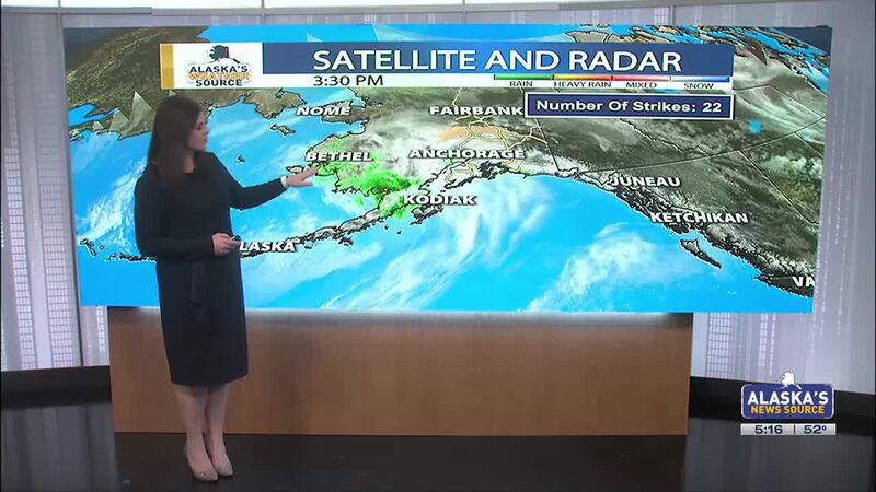
ANCHORAGE, AK (Alaska’s News Source) - While some brief breaks in cloud coverage arrived through the weekend, most locations held onto overcast skies. The persistent showery weather has been with us, with little in the way of reprieve this week. The only exception will be for areas of Southeast, which need some much needed dry time.
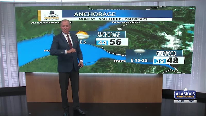
SOUTHCENTRAL:
Isolated to scattered showers remain in the forecast today, although most of the rain will remain confined to coastal regions. Due to the overcast skies, we’ll see temperatures slightly cooler today, with many areas staying in the 50s. The only exception will be for coastal regions, which may stay in the 40s, and areas of the Valley/Copper River Basin, where 60s are possible.
In addition to showers, winds will once again be an issue across Southcentral. Winds will likely gusts upwards of 40 mph across the region, with the highest wind gusts through the Copper River Basin. Palmer and Anchorage will also seeing gusty winds, with winds likely topping out around 3o to 35 mph.
We’ll see a better return to rain into Tuesday, as rain becomes more steady at times. While Tuesday’s morning commute may provide some dry time, expect a general trend towards wetter weather throughout the day. This stretch of wet weather will likely remain with us through Thursday, before things begin to dry out. It’ll be a challenge to hit 60 this week for Anchorage, as the overall weather pattern will likely favor highs in the 50s, with Tuesday and Wednesday being our coolest days.
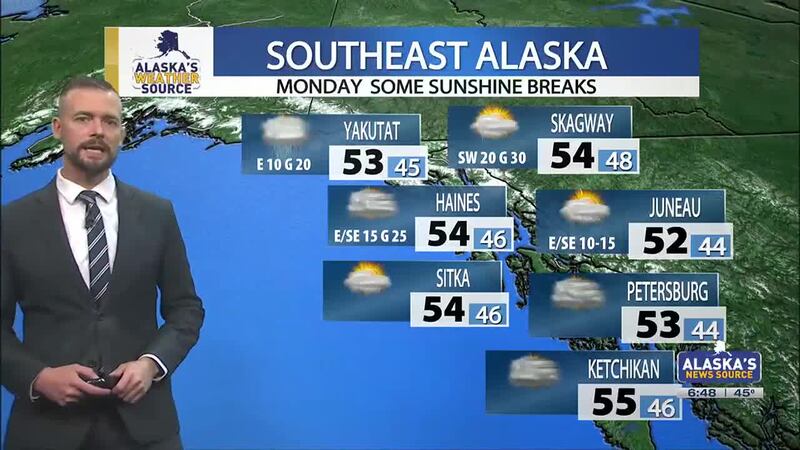
SOUTHEAST:
Brief ridging is building into Southeast, paving the way for some much needed dry time for the panhandle. This drying trend has been with us since yesterday, with today only bringing isolated to scattered showers. Most of the rain looks to favor the northern panhandle, where breezy winds are also possible. Into Tuesday, only stray showers will be likely, with overcast skies remaining for many areas.
Rain and winds look to become more widespread beyond Wednesday, as the overall weather pattern favors more rain in the forecast. With the exceptionally wet weather we saw in May, any heavy rain could lead to additional landslide issues this week. There is some good news for areas of the Southern Inner Channels, as rain will likely amount to well below an inch this week. Little in the way of sunshine and warmth expected this week, as daily highs only climb into the mid 50s.
INTERIOR:
Some areas of blowing dust will impact locations of the Interior today, as gusty winds will be around. While the wind advisory near the Alaska Range has been allowed to expire, we could still see some gusts upwards of 40 mph throughout the day. Some of the strongest winds will remain confined near the Eastern Alaska Range, which is where the greatest threat for blowing dust will occur. With that said, areas as far north as Fairbanks could also see some blowing dust and hazy skies.
While we’ll largely stay on the dry side today, we could see some isolated to scattered showers and storms today. Rain will become more widespread throughout the week, with highs likely cooling off into the upper 50s by weeks end. This will lead to Fairbanks potentially seeing the latest 70 degree day on record. The latest ever recorded is June 7th, with no 70 in the forecast for the foreseeable future.
SLOPE/WESTERN ALASKA:
A seemingly quieter weather pattern is taking hold across the Slope, although temperatures remain below seasonal values. An average high to start of June is in the mid 30s, with this week bringing highs in the upper 20s and lower 30s. We’ll largely stay on the dry side, with breezy winds and some coastal fog sticking around.
Light rain showers is moving through parts of Western and Southwest Alaska, with more rain expected throughout the week. Persistent scattered to periodic showers remain with us, with the activity building as far north as the Seward Peninsula. While rain is expected to be the predominant precipitation type, Gambell/St. Lawrence will see a better chance for some wintry mix. In addition to the showers, expect breezy winds this week, with winds up to 45 mph possible.
ALEUTIANS:
An area of low pressure that has set up shop in the Bering this weekend, continues to lead to widespread rain and winds for the Aleutians. Most of the rain is favoring the Central Aleutians and east, with the activity set to lighten up throughout the day. As the low moves inland to Southwest Alaska, the showers and winds will gradually die down. Overall, expect a wetter, breezier and cooler week for the Aleutians, with highs in the 40s and 50s.
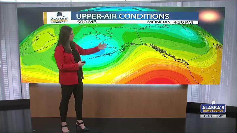
OUTLOOK AHEAD:
Like it or not, the outlook ahead continues to favor a wetter weather pattern for the state. This will keep many areas under cloud cover, with highs maintaining near or slightly below seasonal values. Little in the way of any significant warmth is forecast for Alaska the next week or so, meaning that for some summer will be put on hold for now. It’s looking very likely that Fairbanks will see the latest first 70 degree high on record.
Download the free Alaska’s News Source Weather App.
Send us your weather photos and videos here!
Copyright 2025 Alaska's News Source. All rights reserved.