Early morning landslide in Ketchikan damages house, car as atmospheric river delivers extreme rain
KETCHIKAN, Alaska (KTUU) - An early morning landslide in Ketchikan left one home and a vehicle damaged, but no one injured.
The Ketchikan Fire Department reported that at 1:28 a.m. Wednesday morning, it responded to a landslide off North Tongass Highway.
“Crews arrived to find that a slide had damaged both a home and a vehicle. Thankfully, the occupants were able to evacuate safely and have since relocated while further assessments are completed,” the KFD wrote on social media.
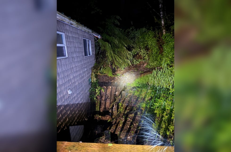
The landslide also damaged a nearby driveway.
As of 11 a.m. Wednesday, the Ketchikan Airport has recorded 6.25 inches of rain in the past 48 hours, and more is coming.
An atmospheric river is bringing a constant stream of moisture to the southern regions of Southeast Alaska. An additional 2-4 inches is likely near Ketchikan through Saturday.
A flood advisory is in effect for the Ward Lake recreational area. Water levels are currently about a foot over minor flood stage on Ward Creek, above the Lake Connell Dam.
According to the National Weather Service in Juneau, the Ketchikan/Misty Fjords USFS Ranger District is also reporting flooding near Signal Creek, including over the road and into campgrounds. They are also reporting at least one downed tree.
More than 20 inches of rain has already fallen in Ketchikan this month, making it the third wettest May on record currently. By the end of the month though, it is quite likely that more than 22.4 inches will have fallen, making it the wettest May ever recorded in Ketchikan.
Stay with Alaksa’s Weather Source for the latest information on this Atmospheric River and the expected impacts from the rain. Download the free Alaska’s News Source Weather App for the latest weather alerts and radar.
If you see weather impacts, send us your weather photos and videos here!
See a spelling or grammar error? Report it to web@ktuu.com
Copyright 2025 KTUU. All rights reserved.